How to Measure Land Accurately | South Texas Surveying
“Accurate land measurement is a critical component of many sectors and can impact everything from legal property transactions to architectural planning and construction.” -Christopher Evans
How to Measure Land: Techniques for Accurate Land Surveying
Measuring land accurately is fundamental to a variety of fields, from real estate and construction to agriculture and environmental management. Proper land measurement ensures clear property boundaries, aids in compliance with local regulations, and helps in effective planning and development. Here’s an overview of how land is measured and how South Texas Surveying can ensure precision and reliability in your land measurement needs.
Understanding Land Measurement Basics
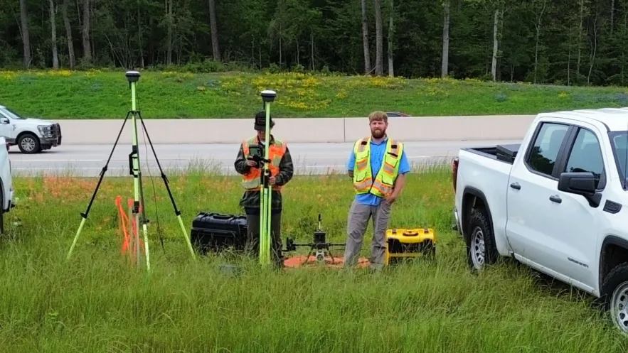
The process of measuring land, commonly known as land surveying, involves determining terrestrial or three-dimensional positions of points and the distances and angles between them. These points are often used to establish maps and boundaries for ownership, locations (like building corners or the surface location of subsurface features), and other purposes required by government or civil law, such as property sales.
Tools and Techniques Used in Land Surveying
GPS Technology: Modern surveying often utilizes Global Positioning System (GPS) technology to provide extremely precise measurements of the land. GPS devices can track satellite signals to pinpoint exact locations on Earth, providing data that is invaluable in mapping large areas with high accuracy.
Theodolites and Total Stations: A theodolite is an instrument for measuring both horizontal and vertical angles. It’s essential for triangulation, which is a fundamental method in surveying. Total stations combine electronic theodolites with an electronic distance meter (EDM) to read slope distances from the instrument to a particular point.
Tape Measures and Chains: For smaller plots or when high-tech equipment is not available, tape measures and surveyor's chains are traditional tools that can still provide accurate measurements. They are particularly useful in measuring the dimensions of a building site or any area requiring minor survey work.
Drones: Increasingly, drones are used in land surveying. They provide a bird’s-eye view and can cover large areas quickly. Drone technology is especially useful for topographical mapping, where detailed images captured from the sky are used to map features and contours of the land.
How South Texas Surveying Can Help
At South Texas Surveying, we are equipped with the latest surveying technology and employ a team of experienced professionals to deliver accurate and reliable land measurement services. Whether you need a detailed survey for a large development project or a simple boundary survey for a residential property, we can provide the precise data you need.
Our services include, but are not limited to:
Boundary Surveys: To determine the physical boundaries of a property.
Topographical Surveys: To identify and map the contours of the ground and existing features on the surface of the earth.
Construction Surveys: To stake out structures on the land, ensuring that construction projects are built in the correct location and to the right specifications.
Accurate land measurement is a critical component of many sectors and can impact everything from legal property transactions to architectural planning and construction. With South Texas Surveying, you gain a partner who understands the intricacies of land surveying. We ensure that every measurement is precise, helping you to plan and execute your projects with confidence.
