Surveying Texas Since 1980 Family Owned, Customer Devoted | Firm #10045400 | 281-556-6918

See Our Latest Blogs
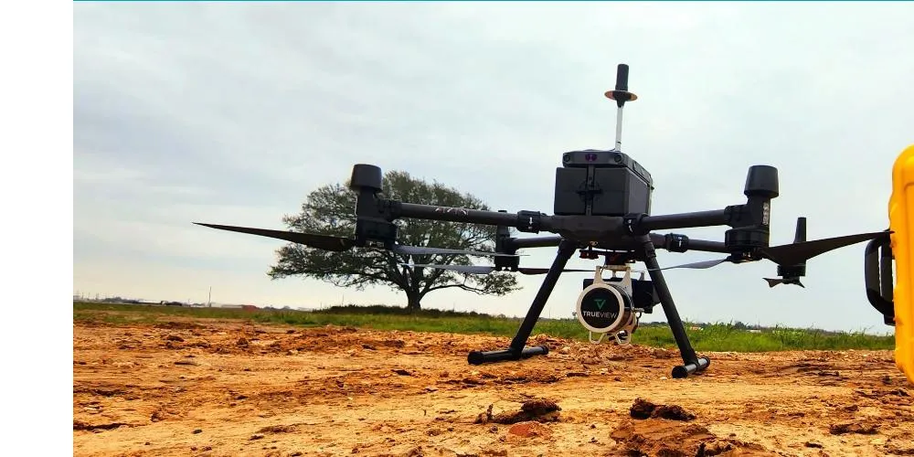
Advantages of Aerial Drone Surveys in Land Management
“What might take traditional surveyors days or even weeks can often be accomplished by a drone in a few hours.” - Fred Lawton
The Unmatched Benefits of Aerial Drone Technology
Aerial drone surveys have revolutionized the field of land surveying and management, offering a range of advantages that traditional methods cannot match. Here's a look at the key benefits of using drone technology in surveying:
Increased Accuracy and Detail
Drones are equipped with high-resolution cameras and advanced sensors that capture detailed images and data from above. This allows for more precise measurements and a better understanding of the land's features. The accuracy of drone surveys is particularly beneficial in complex landscapes where traditional methods might miss subtle nuances.
Time Efficiency
One of the most significant advantages of drone surveys is their ability to cover large areas in a short amount of time. What might take traditional surveyors days or even weeks can often be accomplished by a drone in a few hours. This speed is invaluable in projects with tight deadlines or when multiple sites need to be surveyed simultaneously.
Cost-Effectiveness
While the initial investment in drone technology can be significant, the cost savings over time are substantial. Drones reduce the need for multiple crews and heavy equipment on site, which lowers the overall cost of the surveying process. Additionally, the speed and efficiency of drones mean that more surveys can be conducted in less time, further reducing operational costs.
Enhanced Safety
Drones eliminate the need for surveyors to physically access difficult or dangerous terrain. This not only ensures the safety of the survey team but also reduces the risk of accidents and injuries. By using drones, surveyors can easily access and analyze hazardous sites like steep slopes, busy roadways, or contaminated lands without putting themselves at risk.
Environmental Impact
Drones minimize the environmental impact of surveying activities. They do not require clearing large areas or creating paths, unlike traditional methods that can disturb wildlife or damage sensitive ecosystems. This makes drones an environmentally friendly option for conducting surveys, especially in ecologically sensitive areas.
Versatility
Drones are incredibly versatile and can be used for a variety of surveying tasks, including topographical surveys, environmental monitoring, construction site inspections, and more. They can also be equipped with different sensors to gather specific types of data, such as thermal imaging for energy audits or multispectral sensors for agricultural assessments.
Data Integration
The data collected by drones can easily be integrated with GIS and other land management systems. This seamless integration allows for better data management and accessibility, enabling more informed decision-making and efficient project planning.
Aerial drone surveys offer a modern solution to many of the challenges faced in traditional surveying. By embracing this technology, land managers and surveyors can enhance their capabilities, improve safety, and reduce costs, all while obtaining high-quality data that supports better decision-making.
Trust South Texas Surveying to guide you through the complexities of buying land in Texas, ensuring your vision for your property becomes a reality.

Delivering Land Surveys with Attention to Detail
George Owens
Commercial Broker

I have worked with many surveying companies, but South Texas Surveying stands out for their exceptional professionalism, attention to detail, and commitment to their clients.
Kim Wexler
Project Manager
Their accurate and thorough surveys make my job a lot easier, their ability to communicate effectively with all parties involved is commendable. I highly recommend South Texas Surveying.
James Cart
Homeowner
As a new homeowner, I was thoroughly impressed with the professional service provided by South Texas Surveying. I high recommend their services to any one buying a home in Houston.
Contact Us
Email: [email protected]
Office Address: 11281 Richmond Ave
BLDG J, Suite 101,
Houston, TX 77082
Office Hours: Mon – Fri 8:00am – 5:00pm
Office Phone Number: 281-556-6918
11281 Richmond Ave
BLDG J, Suite 101,
Houston, TX 77082
Firm Number: 10045400
Resources
© Copyright 2024 South Texas Surveying Associates