Surveying Texas Since 1980 Family Owned, Customer Devoted | Firm #10045400 | 281-556-6918

See Our Latest Blogs
How Drone Technology Enhances Land Surveys in Houston’s Commercial Market
"Texas, often referred to as the Lone Star State, is a thriving hub for economic growth and innovation, making it an attractive destination for commercial real estate investment." - Chris Evans
The Impact of Drone Technology on Land Surveys in Houston’s Commercial Market
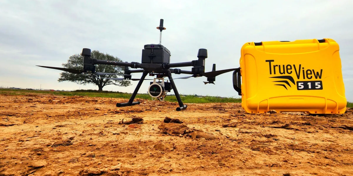
As Houston's commercial real estate market continues to expand, the demand for efficient and precise land surveying solutions has never been higher. Traditional land surveying methods, while reliable, can be time-consuming, labor-intensive, and challenging in large or hard-to-access areas. This is where drone technology is making a game-changing impact. Drones, or Unmanned Aerial Vehicles (UAVs), are revolutionizing land surveying by enhancing accuracy, efficiency, and accessibility in ways that benefit developers, surveyors, and property owners alike.
In this article, we’ll explore how drones are transforming land surveying for Houston's commercial market, the benefits they offer, and how they contribute to faster, more comprehensive survey results.
The Role of Drone Technology in Modern Land Surveys
Drones are increasingly becoming an essential tool in land surveying, especially in the commercial sector. Equipped with high-resolution cameras, GPS, and even LiDAR (Light Detection and Ranging) sensors, drones capture detailed aerial images and data that surveyors use to create accurate, 3D maps of the land. Here’s how drone technology enhances land surveying:
1. Aerial Mapping and Data Collection
Drones provide a bird's-eye view of large commercial sites, making it easy to map out boundaries, terrain features, and existing infrastructure. High-resolution images captured by drones are processed to create 3D models and contour maps, allowing surveyors to analyze topography and landscape features with precision.
2. Increased Speed and Efficiency
Traditional surveys, particularly for large commercial properties, can take days or even weeks to complete. Drones significantly reduce this time, as they can capture large amounts of data in a fraction of the time. With drones, a surveyor can collect comprehensive data on a large property in a matter of hours, speeding up the entire development process.
3. Enhanced Accuracy and Detail
Drone technology enhances accuracy by providing high-resolution imagery and precise GPS data. This data allows surveyors to create highly accurate 3D models and measurements, ensuring that developers and investors have the exact information they need to make informed decisions.
4. Access to Hard-to-Reach Areas
In Houston’s commercial market, properties can vary from high-rise sites in urban areas to sprawling tracts of land on the city’s outskirts. Drones can reach areas that are difficult for surveyors to access on foot, such as heavily wooded areas, wetlands, or construction sites with rough terrain.
5. Reduced Safety Risks
Traditional land surveys may require surveyors to navigate challenging landscapes, busy roadways, or hazardous construction sites. Drones eliminate the need for surveyors to physically enter these areas, reducing safety risks and allowing for safer data collection in difficult conditions.
Benefits of Using Drones for Land Surveys in Houston’s Commercial Market
For developers, surveyors, and commercial property owners, the use of drone technology offers multiple benefits that improve the speed, safety, and accuracy of land surveys. Here’s why drones are gaining popularity in Houston’s booming commercial real estate market:
1. Faster Project Timelines
With the fast-paced growth of Houston’s commercial sector, time is often a critical factor. Drones provide surveyors with the ability to collect data more quickly than traditional methods, allowing developers to start projects sooner. This efficiency can also save time on future surveys, as drones can quickly re-survey a site if updates are needed.
2. Lower Surveying Costs
Traditional surveying methods can be labor-intensive and may require additional equipment. Drones reduce labor needs and minimize equipment costs, making land surveying more affordable. For large commercial properties, the savings from using drones can be substantial.
3. High-Resolution Data for Detailed Analysis
Drones capture high-resolution imagery that can reveal fine details about the land, such as subtle elevation changes, potential drainage issues, and vegetation patterns. This detailed data is invaluable for developers, as it enables them to make informed decisions about site design, construction planning, and environmental impact.
4. Enhanced Site Planning and Design
Drones provide an accurate view of the entire site, making it easier for architects and engineers to design around natural features, optimize land use, and plan infrastructure such as access roads, utilities, and green spaces. This holistic view of the property helps create more efficient, aesthetically pleasing, and environmentally friendly commercial developments.
5. Simplified Compliance with Regulations
In Houston, like in many cities, land use and development must comply with various regulations and zoning laws. Drones allow surveyors to gather all necessary data in a format that can be easily shared with regulatory bodies, ensuring that properties meet zoning requirements, environmental standards, and other legal guidelines.
Key Applications of Drone Technology in Commercial Land Surveys
Drone technology can be applied in various ways to support commercial real estate development in Houston. Here are some key applications of drones in land surveys:
1. Boundary and Property Line Mapping
Drones help surveyors accurately map property boundaries, capturing data that ensures compliance with local zoning laws and eliminates disputes over land ownership. This is particularly important for large commercial developments, where boundary accuracy is crucial.
2. Topographic Mapping and Terrain Analysis
Topographic mapping allows developers to understand the terrain, slope, and elevation of a property. Drones equipped with LiDAR sensors can generate detailed contour maps, helping engineers design grading, drainage, and foundation plans that fit the natural landscape.
3. Volume Measurement for Earthworks
For construction projects involving significant earthwork, such as grading and excavation, drones can calculate precise volume measurements. These measurements are essential for estimating the amount of soil or fill needed for the project, helping developers manage costs and avoid overuse of resources.
4. Environmental Impact Assessments
Drones are used to monitor vegetation, water bodies, and wildlife habitats on commercial properties. This data helps assess environmental impact, identify protected areas, and plan developments in a way that minimizes ecological disturbance, ensuring compliance with environmental regulations.
5. Construction Monitoring and Progress Tracking
Drones are valuable tools for tracking construction progress on commercial sites. Regular drone flights over the site provide updated images and data, helping developers monitor the project’s progress, document milestones, and ensure that construction stays on schedule and within specifications.
Steps Involved in Conducting a Drone-Based Land Survey
Conducting a drone-based land survey involves several steps to ensure accuracy, safety, and compliance with local laws. Here’s a look at the process:
1. Pre-Survey Planning
The surveyor assesses the property and determines the specific data needed, such as boundaries, topography, or environmental features. The survey team then creates a flight plan, ensuring all areas are covered within legal drone operation limits.
2. Obtaining Necessary Permits and Clearances
In Houston, certain commercial areas may require permits or clearances for drone flights. Surveyors work with local authorities to ensure they have permission to fly drones over the property, especially in urban areas or near airports.
3. Data Collection via Drone Flights
Using drones equipped with high-resolution cameras or LiDAR sensors, surveyors conduct multiple flights over the property, collecting data in the form of images, videos, or 3D point clouds. This data provides a detailed visual representation of the land.
4. Data Processing and Analysis
The collected data is processed using specialized software to create maps, 3D models, and reports. This information is analyzed to provide insights into property boundaries, topography, or any environmental considerations for the development.
5. Report Creation and Delivery
Surveyors compile the processed data into a report that includes maps, measurements, and detailed observations. This report is shared with developers, architects, or property owners to inform the next steps in the development process.
Frequently Asked Questions (FAQs)
Are drone surveys more accurate than traditional surveys?
Drone surveys can be just as accurate as traditional methods and often provide additional detail. Drones capture high-resolution images and data that enhance the precision of measurements, especially for large or complex properties.
Do drone surveys cost less than traditional land surveys?
Yes, drone surveys often cost less than traditional surveys due to reduced labor, faster data collection, and minimal need for ground-based equipment. However, the cost may vary depending on the survey’s scope and the property’s size.
Are drone surveys allowed in all areas of Houston?
While drones can be used in most areas, certain restrictions apply, especially near airports and densely populated areas. Surveyors obtain any necessary permits or clearances before conducting a drone survey in restricted areas.
How do drones handle challenging terrains?
Drones excel in difficult-to-access areas like dense forests, wetlands, and rough terrain. They capture images and data from above, eliminating the need for surveyors to navigate challenging or hazardous landscapes.
Can drone surveys be used for environmental assessments?
Yes, drones are highly effective for environmental assessments. They can capture images and data on vegetation, water bodies, and protected habitats, helping developers assess environmental impacts and plan accordingly.
How quickly can a drone survey be completed?
A drone survey can often be completed in a few hours, depending on the size of the property and the survey’s complexity. Processing the data may take additional time, but overall, drone surveys are faster than traditional methods.
In Houston’s fast-paced commercial real estate market, drone technology is revolutionizing land surveys by providing efficient, accurate, and cost-effective data collection. From boundary mapping and topographic analysis to environmental assessments and construction monitoring, drones offer unparalleled insights that support smarter, safer, and faster development. For property developers, surveyors, and real estate investors in Houston, drone-based surveys are a valuable tool for achieving precise results and accelerating project timelines.
At South Texas Surveying, we’re committed to using the latest technology to deliver comprehensive land survey solutions. Contact us today to learn how drone surveys can enhance your commercial property development in Houston.
Interested in the benefits of drone technology for your land survey? Contact South Texas Surveying for expert drone-based survey services tailored to the Houston commercial market.

Delivering Land Surveys with Attention to Detail
George Owens
Commercial Broker

I have worked with many surveying companies, but South Texas Surveying stands out for their exceptional professionalism, attention to detail, and commitment to their clients.
Kim Wexler
Project Manager
Their accurate and thorough surveys make my job a lot easier, their ability to communicate effectively with all parties involved is commendable. I highly recommend South Texas Surveying.
James Cart
Homeowner
As a new homeowner, I was thoroughly impressed with the professional service provided by South Texas Surveying. I high recommend their services to any one buying a home in Houston.
Contact Us
Email: [email protected]
Office Address: 11281 Richmond Ave
BLDG J, Suite 101,
Houston, TX 77082
Office Hours: Mon – Fri 8:00am – 5:00pm
Office Phone Number: 281-556-6918
11281 Richmond Ave
BLDG J, Suite 101,
Houston, TX 77082
Firm Number: 10045400
Resources
© Copyright 2024 South Texas Surveying Associates