Surveying Texas Since 1980 Family Owned, Customer Devoted | Firm #10045400 | 281-556-6918

See Our Latest Blogs
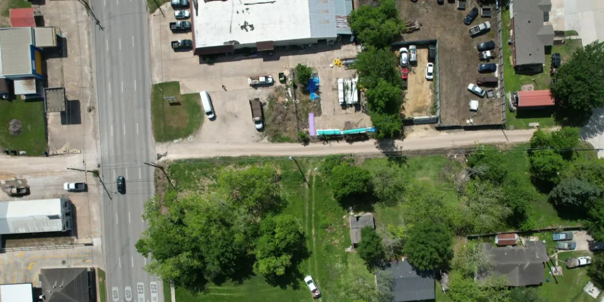
Elevation Certificates: A Must for Commercial Properties in Houston
"Texas, often referred to as the Lone Star State, is a thriving hub for economic growth and innovation, making it an attractive destination for commercial real estate investment." - Chris Evans
Elevation Certificates: A Must for Commercial Properties in Houston
In a city like Houston, where flooding is a recurring problem, elevation certificates are essential for commercial properties. Understanding the role they play in real estate, insurance, and flood mitigation can significantly affect how businesses manage their properties. For those unfamiliar with the requirements and significance of elevation certificates, this guide provides a comprehensive explanation of why they are crucial for commercial properties in the Houston area.
What Is an Elevation Certificate?
An elevation certificate is a document issued by a licensed land surveyor, engineer, or architect, verifying the elevation of a property in relation to the base flood elevation (BFE). This document provides vital information on the property’s flood zone, which is determined by FEMA (Federal Emergency Management Agency) flood maps. It includes data on the elevation of the building's lowest floor, and other structural aspects that could affect flood insurance rates.
For commercial properties in Houston, which sits on low-lying land prone to heavy rainfall and flooding, this document is especially important. It not only helps property owners understand their flood risk but also plays a key role in determining flood insurance premiums.
Why Elevation Certificates Are Crucial in Houston
Houston has a long history of flooding, often exacerbated by hurricanes and tropical storms. Flood risk is significant across many parts of the city, and for commercial property owners, understanding that risk is critical. Elevation certificates are one of the most effective tools to assess the level of flood threat a property faces.
Flood Risk Management
Houston’s landscape is heavily influenced by bayous, creeks, and rivers, and the city is prone to flash flooding. Having an elevation certificate allows property owners to make informed decisions about necessary flood mitigation measures, such as installing flood barriers, building levees, or using flood-resistant building materials.Compliance with Local and Federal Regulations
Commercial properties in designated flood zones must adhere to specific regulations, such as building codes that require structures to be elevated above the BFE. Failing to comply with these regulations can result in fines or even the inability to secure building permits. An elevation certificate is a critical part of this compliance process.Impact on Flood Insurance Premiums
Flood insurance is mandatory for properties located in high-risk flood zones that have federally-backed mortgages. FEMA uses elevation certificates to help insurers determine the appropriate premium rates. The lower the lowest floor of the building is in relation to the BFE, the higher the insurance premium is likely to be. On the flip side, properties with favorable elevation data may qualify for lower rates, saving property owners significant amounts of money.Selling or Buying Commercial Property
For real estate transactions involving commercial properties in Houston, an elevation certificate is often required. Buyers want to know the flood risk associated with a property before making an investment. Additionally, some lenders may require an elevation certificate to finalize financing, particularly for properties in flood-prone areas.
How Elevation Certificates Help Commercial Property Owners
Elevation certificates are not just a regulatory requirement but a vital tool for managing flood risk and ensuring the long-term value of commercial properties.
Minimizing Insurance Costs
One of the primary benefits of having an elevation certificate is the potential reduction in flood insurance costs. For commercial properties, insurance can be a substantial expense, particularly in high-risk areas like Houston. With an elevation certificate showing that the building is above the BFE, property owners can negotiate for lower premiums. This could mean significant savings over time.Ensuring Proper Coverage
Without an elevation certificate, property owners may be forced to accept generalized insurance rates that don’t reflect the true risk of their property. This can either leave owners underinsured or paying far more than necessary. Accurate elevation data helps insurers provide more precise coverage tailored to the specific risk level of the property.Aid in Disaster Planning
Houston’s susceptibility to floods means that commercial property owners need to be proactive in disaster planning. An elevation certificate offers critical data that can be used to develop flood emergency plans. It helps identify which parts of the property are most vulnerable and require the most protection during a flood event.Enhancing Property Value
A property with a lower flood risk, as indicated by an elevation certificate, will likely be more attractive to potential buyers or tenants. If your commercial property is in an area prone to flooding but has favorable elevation data, it could command a higher market value compared to similar properties without the documentation.
How to Obtain an Elevation Certificate in Houston
Obtaining an elevation certificate in Houston requires the services of a licensed land surveyor, engineer, or architect. These professionals are authorized to complete FEMA’s Elevation Certificate form, which involves measuring the property's elevation relative to the BFE.
Here’s a step-by-step guide on how to get an elevation certificate:
Contact a Licensed Surveyor or Engineer
The first step is to hire a licensed professional. In Houston, many surveying companies specialize in flood zone analysis and can provide this service. Be sure to hire someone familiar with local floodplain management regulations.Surveying the Property
The professional will survey your property, measuring the elevation of various structural components, including the lowest floor and any attached garages or equipment that could be impacted by floodwaters.Submit the Information to FEMA
Once the survey is complete, the professional will fill out FEMA's Elevation Certificate form with all the required data. This includes detailed elevation measurements and information about the building's construction, which helps FEMA determine the property's flood risk.Use the Certificate for Insurance and Compliance
After obtaining the elevation certificate, property owners should provide a copy to their insurance company and keep one on file for compliance with local floodplain management requirements.
How Elevation Certificates Affect Flood Zones in Houston
Houston’s floodplains are regularly updated based on changing environmental conditions, development, and updated technology. FEMA continually revises its flood zone maps, which can change a property’s flood risk classification. When flood maps are revised, some properties may find themselves newly classified as high-risk, while others may be removed from these zones.
An elevation certificate provides a more granular look at flood risk than FEMA’s generalized flood maps. It allows property owners to challenge incorrect flood zone classifications. If the certificate shows that the property is at a lower risk than the FEMA maps indicate, the owner can request a Letter of Map Amendment (LOMA) to adjust the flood zone classification. This process could result in lower insurance premiums and fewer regulatory restrictions.
The Role of Surveyors in the Elevation Certificate Process
Surveyors play a crucial role in the elevation certificate process. They are responsible for accurately assessing a property’s elevation and ensuring that all measurements comply with FEMA’s guidelines. Surveyors also assist in interpreting flood maps and determining whether a property is in a flood zone. For commercial property owners in Houston, working with a knowledgeable and experienced surveyor is essential to obtaining a precise elevation certificate.
Surveyors also help with floodplain management. In areas where development is constrained by flood risks, surveyors provide essential data for planning construction projects that meet local regulations and reduce flood damage.
Common Misconceptions About Elevation Certificates
There are several misconceptions about elevation certificates that can lead to confusion among commercial property owners in Houston.
Misconception: An Elevation Certificate Is Only Necessary for High-Risk Zones
Reality: Even properties outside of high-risk zones can benefit from an elevation certificate. Floods don’t always adhere to FEMA maps, and understanding a property’s specific flood risk is always advantageous.Misconception: Elevation Certificates Are a One-Time Requirement
Reality: Elevation certificates may need to be updated if significant changes are made to the property, such as construction, additions, or modifications that affect the building’s elevation.Misconception: Elevation Certificates Guarantee Lower Insurance Rates
Reality: While elevation certificates can help reduce insurance premiums, they don’t guarantee it. Properties with poor elevation in relation to the BFE will still face high premiums, but having the certificate ensures you are paying the correct amount.
Conclusion
For commercial property owners in Houston, an elevation certificate is an indispensable tool for managing flood risks, reducing insurance premiums, and ensuring compliance with federal and local regulations. Given Houston’s history with flooding, understanding the importance of elevation certificates and incorporating them into your property management strategy is critical. Working with a qualified surveyor to obtain an accurate elevation certificate will protect your property, reduce financial risks, and help you make informed decisions regarding insurance and flood mitigation.
FAQs
1. What is the purpose of an elevation certificate?
The primary purpose of an elevation certificate is to provide precise information about a building’s elevation relative to the base flood elevation, which is essential for determining flood insurance premiums and ensuring compliance with local building codes.
2. How much does it cost to obtain an elevation certificate in Houston?
The cost of an elevation certificate can vary depending on the size of the property and the complexity of the survey, but typically ranges from $500 to $2,000.
3. Is an elevation certificate mandatory for all commercial properties in Houston?
It is mandatory for properties located in high-risk flood zones that require flood insurance through federally backed loans. However, even properties outside these zones can benefit from having an elevation certificate.
4. How long does it take to get an elevation certificate?
The time frame depends on the availability of the surveyor and the size of the property. Generally, it can take anywhere from one to three weeks to complete the survey and receive the certificate.
5. Can an elevation certificate lower my flood insurance premiums?
Yes, if the elevation certificate shows that your property is above the base flood elevation, it may result in lower flood insurance premiums.
6. Do I need a new elevation certificate after renovating my commercial property?
If the renovations significantly change the building’s elevation, or if they involve the addition of structures like garages or mechanical equipment, a new elevation certificate may be required.

Delivering Land Surveys with Attention to Detail
George Owens
Commercial Broker

I have worked with many surveying companies, but South Texas Surveying stands out for their exceptional professionalism, attention to detail, and commitment to their clients.
Kim Wexler
Project Manager
Their accurate and thorough surveys make my job a lot easier, their ability to communicate effectively with all parties involved is commendable. I highly recommend South Texas Surveying.
James Cart
Homeowner
As a new homeowner, I was thoroughly impressed with the professional service provided by South Texas Surveying. I high recommend their services to any one buying a home in Houston.
Contact Us
Email: [email protected]
Office Address: 11281 Richmond Ave
BLDG J, Suite 101,
Houston, TX 77082
Office Hours: Mon – Fri 8:00am – 5:00pm
Office Phone Number: 281-556-6918
11281 Richmond Ave
BLDG J, Suite 101,
Houston, TX 77082
Firm Number: 10045400
Resources
© Copyright 2024 South Texas Surveying Associates