Surveying Texas Since 1980 Family Owned, Customer Devoted | Firm #10045400 | 281-556-6918

See Our Latest Blogs
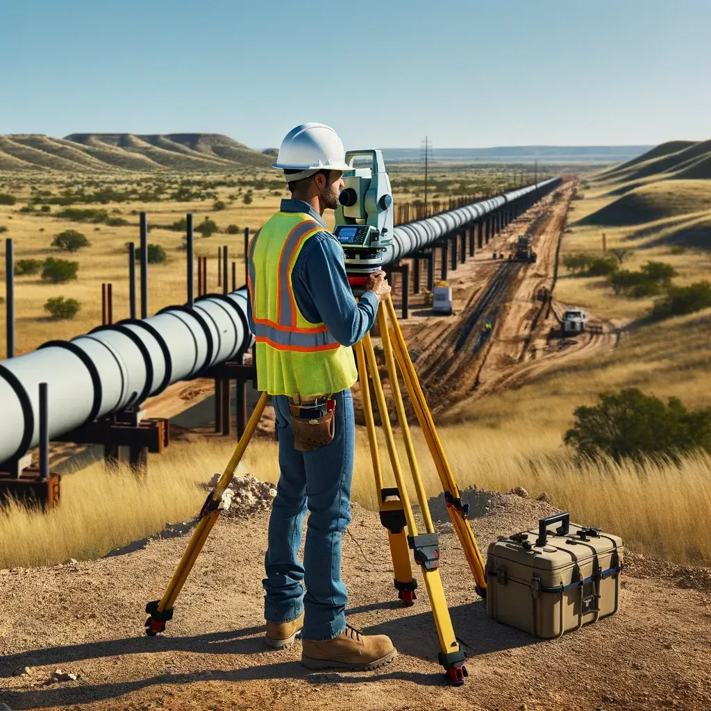
Elevation Surveys for Commercial Construction in Austin’s Flood Zones
"Texas, often referred to as the Lone Star State, is a thriving hub for economic growth and innovation, making it an attractive destination for commercial real estate investment." - Chris Evans
Elevation Surveys for Commercial Construction in Austin’s Flood Zones
Austin is known for its thriving commercial real estate market, but many parts of the city are also susceptible to flooding, especially areas near the Colorado River and in low-lying neighborhoods. For developers and property owners planning commercial construction in these flood-prone areas, conducting elevation surveys is a critical step in ensuring that the project is both safe and compliant with local, state, and federal regulations.
An elevation survey provides detailed information about the height of the land in relation to established flood elevation levels. This data is essential for determining the feasibility of a project, securing the necessary permits, and protecting the property from potential flood damage. In this article, we’ll explore the importance of elevation surveys in Austin’s commercial construction industry and how they help mitigate flood risks.
What is an Elevation Survey?
An elevation survey, also known as a flood elevation survey or elevation certificate, measures the elevation of a property’s land, structures, and features in relation to the Base Flood Elevation (BFE). The BFE is the calculated elevation at which there is a 1% chance of flooding in any given year, also known as the 100-year floodplain.
In Austin, which has several flood zones designated by the Federal Emergency Management Agency (FEMA), elevation surveys are often required for commercial construction projects to ensure that new buildings are constructed above the BFE, minimizing the risk of flood damage.
Why Elevation Surveys are Essential for Commercial Construction in Austin’s Flood Zones
1. Compliance with FEMA and City of Austin Regulations
Commercial construction projects in Austin’s flood zones must adhere to strict guidelines set forth by both FEMA and the City of Austin’s Floodplain Office. These regulations are designed to reduce flood risk and ensure that buildings in flood-prone areas are constructed in a way that minimizes potential damage.
An elevation survey is required to demonstrate that the proposed construction site meets the minimum elevation requirements set by FEMA’s Flood Insurance Rate Maps (FIRM) and Austin’s local floodplain regulations. Without this survey, developers may face delays in obtaining building permits or risk being denied approval for their project altogether.
For example, in Austin’s 100-year floodplain, commercial buildings must typically be elevated at least one foot above the BFE. Elevation surveys provide the precise data needed to confirm that the building site complies with these regulations.
2. Reducing Flood Insurance Costs
In flood-prone areas, flood insurance is often required for commercial properties, especially for businesses seeking loans from lenders. The cost of flood insurance is largely determined by the elevation of the building relative to the BFE. Properties that are elevated above the BFE generally have lower flood insurance premiums, while those below the BFE may face significantly higher costs.
By conducting an elevation survey, commercial property owners can provide FEMA’s National Flood Insurance Program (NFIP) with the necessary data to determine their flood insurance rates. Ensuring that the building is constructed above the BFE not only reduces the risk of flood damage but also lowers ongoing insurance costs, making the property more attractive to potential buyers or tenants.
3. Ensuring the Safety and Longevity of the Structure
Flooding can cause severe damage to commercial buildings, leading to costly repairs, business interruptions, and, in extreme cases, the complete loss of property. Elevation surveys help mitigate these risks by providing the data needed to ensure that new commercial buildings are constructed at a safe elevation above potential flood levels.
In Austin, where flash floods are common, especially during heavy rain seasons, building at the correct elevation is crucial for protecting both the structure and the people who work in it. Elevation surveys provide developers with the information they need to design buildings that can withstand the challenges of the local environment, ensuring the long-term safety and viability of the project.
4. Supporting Site Design and Drainage Planning
In addition to helping with regulatory compliance, elevation surveys are a valuable tool for site design and drainage planning. For commercial properties in flood-prone areas, proper drainage is essential for preventing water from pooling around the building or overwhelming the site’s stormwater management systems.
An elevation survey provides detailed information about the slope and contours of the land, allowing architects and engineers to design drainage systems that effectively channel water away from the building and prevent flooding. In Austin, where urban flash flooding is a frequent concern, designing with accurate elevation data ensures that the project can handle significant rainfall events without causing damage to the property or surrounding areas.
5. Avoiding Costly Project Delays
Failing to conduct an elevation survey early in the planning process can lead to significant delays for commercial construction projects in Austin’s flood zones. Without accurate elevation data, developers may discover late in the process that their proposed building site does not meet FEMA or local floodplain requirements, forcing them to redesign the project or apply for variances.
By conducting an elevation survey at the outset, developers can avoid these setbacks and move forward with confidence, knowing that their project complies with all necessary regulations. This helps keep the project on schedule and prevents costly changes later in the construction process.
6. Supporting Variance Requests or Rezonings
In some cases, developers may wish to build in flood-prone areas that require special permissions or variances from local floodplain regulations. An elevation survey provides the necessary data to support a request for a variance, demonstrating that the property will be constructed in a way that mitigates flood risk and complies with the intent of floodplain management rules.
For example, if a developer in South Austin wants to build in an area with a high risk of flooding, they may need to apply for a variance to modify the standard elevation requirements. The elevation survey provides the detailed data needed to make the case that the building will be safe and that the risk of flooding has been appropriately managed.
Steps in Conducting an Elevation Survey for Commercial Projects
Conducting an elevation survey involves several key steps, each of which is crucial for ensuring accurate results and regulatory compliance:
1. Hiring a Licensed Surveyor
The first step in conducting an elevation survey is to hire a licensed land surveyor with experience in floodplain surveys. In Texas, only licensed surveyors are authorized to perform this work, and it’s important to choose a surveyor who understands both FEMA requirements and local regulations specific to Austin.
2. Collecting Site Data
During the survey, the surveyor will collect detailed measurements of the property’s elevation, including the ground level and any existing or planned structures. This data is used to create an elevation certificate, which documents the property’s elevation in relation to the BFE.
3. Submitting the Elevation Certificate
Once the survey is complete, the surveyor will prepare the elevation certificate, which must be submitted to both FEMA and the City of Austin to demonstrate that the project complies with all applicable floodplain regulations. The elevation certificate is a critical document for obtaining building permits, flood insurance, and variances.
4. Integrating the Survey Data into the Design
The data from the elevation survey should be integrated into the project’s overall site design and engineering plans. Architects, engineers, and builders use this information to design the building, drainage systems, and infrastructure in a way that minimizes flood risks and ensures the project complies with local floodplain management rules.
Frequently Asked Questions (FAQs)
What is an elevation survey?
An elevation survey measures the elevation of a property’s land and structures relative to the Base Flood Elevation (BFE), which is the level at which there is a 1% annual chance of flooding.
Why are elevation surveys important for commercial construction in Austin?
Elevation surveys are required for commercial construction in flood-prone areas to ensure that buildings are constructed above the flood level, reducing the risk of damage and ensuring compliance with FEMA and City of Austin floodplain regulations.
How do elevation surveys affect flood insurance costs?
Elevation surveys provide data on a building’s elevation relative to the BFE, which directly impacts the cost of flood insurance. Buildings constructed above the BFE generally have lower insurance premiums.
What happens if a commercial project is built without an elevation survey?
Without an elevation survey, developers may face delays in obtaining building permits, higher flood insurance costs, and the risk of violating floodplain regulations, leading to fines or required modifications to the project.
When should an elevation survey be conducted?
An elevation survey should be conducted early in the planning stages of any commercial construction project located in a flood zone. This ensures that the project complies with all necessary regulations before construction begins.
Can elevation surveys help secure a variance for building in a flood zone?
Yes, elevation surveys provide the data needed to support a variance request by demonstrating that the building will be constructed at a safe elevation and that flood risks have been appropriately mitigated.
Conclusion: The Crucial Role of Elevation Surveys in Austin’s Flood Zones
For developers planning commercial construction in Austin’s flood-prone areas, conducting an elevation survey is essential for ensuring that the project meets FEMA and local floodplain regulations. By providing accurate elevation data, these surveys help reduce flood risks, lower flood insurance costs, and prevent costly project delays. As flooding remains a significant concern in Austin, elevation surveys play a vital role in ensuring that commercial buildings are safe, compliant, and resilient in the face of future flood events.

Delivering Land Surveys with Attention to Detail
George Owens
Commercial Broker

I have worked with many surveying companies, but South Texas Surveying stands out for their exceptional professionalism, attention to detail, and commitment to their clients.
Kim Wexler
Project Manager
Their accurate and thorough surveys make my job a lot easier, their ability to communicate effectively with all parties involved is commendable. I highly recommend South Texas Surveying.
James Cart
Homeowner
As a new homeowner, I was thoroughly impressed with the professional service provided by South Texas Surveying. I high recommend their services to any one buying a home in Houston.
Contact Us
Email: [email protected]
Office Address: 11281 Richmond Ave
BLDG J, Suite 101,
Houston, TX 77082
Office Hours: Mon – Fri 8:00am – 5:00pm
Office Phone Number: 281-556-6918
11281 Richmond Ave
BLDG J, Suite 101,
Houston, TX 77082
Firm Number: 10045400
Resources
© Copyright 2024 South Texas Surveying Associates