Surveying Texas Since 1980 Family Owned, Customer Devoted | Firm #10045400 | 281-556-6918

See Our Latest Blogs
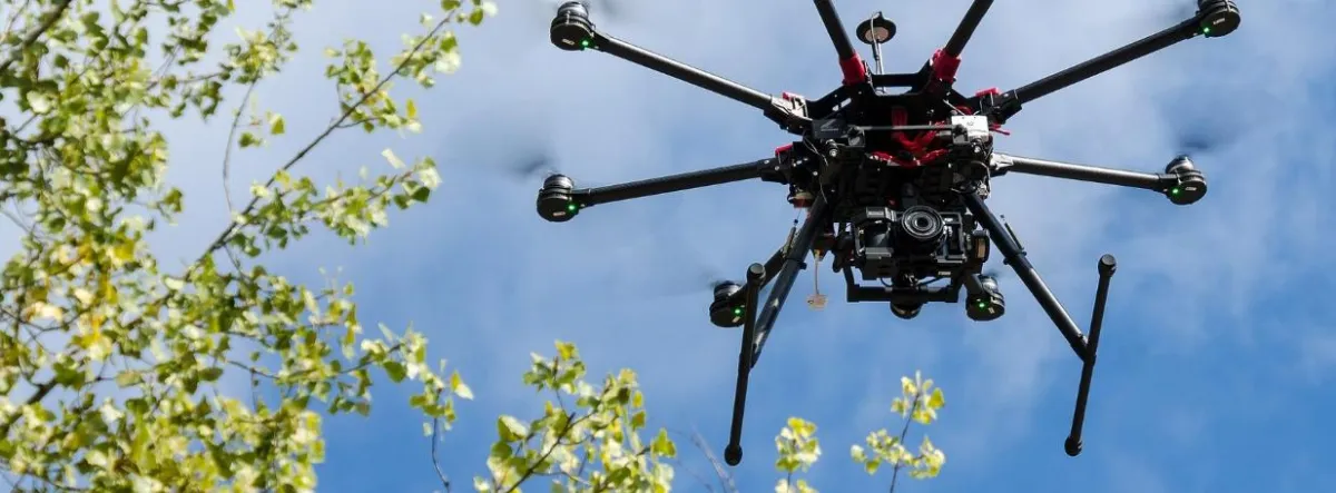
The Impact of LiDAR Drones on Texas Land Surveying
“The most significant impacts of LiDAR drones in land surveying is the level of accuracy they provide.” - Fred Lawton
LiDAR Drones are Revolutionizing Texas Land Surveying
Land surveying in Texas is experiencing a technological revolution, with Light Detection and Ranging (LiDAR) drones leading the charge. These advanced aerial vehicles are equipped with sensors that use laser light to measure distances to the earth's surface. By offering detailed, accurate topographical data, LiDAR drones are transforming how surveyors in Texas map and understand the land, ultimately enhancing the efficiency and effectiveness of their work.
Enhanced Data Accuracy
One of the most significant impacts of LiDAR drones in land surveying is the level of accuracy they provide. Traditional ground-based survey methods can be limited by physical obstacles and the vast size of properties, especially in Texas where ranches and commercial lands stretch over large areas. LiDAR drones overcome these limitations by capturing high-resolution images and data from above, ensuring that no detail is missed. This accuracy is crucial for everything from construction planning to environmental monitoring and legal documentation.
Speed and Efficiency
LiDAR-equipped drones can survey large tracts of land in a fraction of the time it takes traditional methods. This rapid data collection is invaluable in a state like Texas, where the speed of development often moves quickly. By reducing the time needed for surveying, projects can progress faster, reducing costs and allowing quicker responses to market or environmental changes.
Versatility Across Environments
Texas is known for its diverse landscapes, from dense forests and coastal plains to rugged hills and arid deserts. LiDAR drones excel in providing accurate data across these varied terrains. Whether it's mapping flood-prone areas along the Gulf Coast or planning oil pipeline routes in the Permian Basin, LiDAR drones deliver consistent and reliable data, enabling precise planning and decision-making.
Improving Safety
Surveying certain terrains can be hazardous. Dense woods, steep cliffs, and remote areas pose risks to surveyors. LiDAR drones minimize these risks by remotely accessing difficult-to-reach or dangerous areas. This not only keeps survey teams safe but also reduces the liability and insurance costs associated with high-risk surveying tasks.
Environmental Impact and Conservation
Environmental conservation is a crucial consideration in Texas, given its rich biodiversity and significant natural resources. LiDAR drones play a vital role in environmental impact assessments by providing detailed images that help identify ecological features and habitats without the need for disruptive ground surveys. This capability makes it easier to plan developments while complying with environmental regulations and preserving the natural landscape.
Integration with GIS and Other Technologies
LiDAR data is highly compatible with Geographic Information Systems (GIS) and other analytical tools, allowing for sophisticated processing and visualization of the landscape. This integration enables surveyors and developers to create detailed 3D models of the terrain, analyze the spatial relationships of different land features, and simulate various developmental or environmental scenarios before any physical changes are made to the land.
The use of LiDAR drones in Texas land surveying is more than just an upgrade; it's a complete overhaul of traditional practices. As this technology continues to evolve, its integration into surveying work promises to further enhance the accuracy, efficiency, and safety of land development projects across the state.
Trust South Texas Surveying to guide you through the complexities of buying land in Texas, ensuring your vision for your property becomes a reality.

Delivering Land Surveys with Attention to Detail
George Owens
Commercial Broker

I have worked with many surveying companies, but South Texas Surveying stands out for their exceptional professionalism, attention to detail, and commitment to their clients.
Kim Wexler
Project Manager
Their accurate and thorough surveys make my job a lot easier, their ability to communicate effectively with all parties involved is commendable. I highly recommend South Texas Surveying.
James Cart
Homeowner
As a new homeowner, I was thoroughly impressed with the professional service provided by South Texas Surveying. I high recommend their services to any one buying a home in Houston.
Contact Us
Email: [email protected]
Office Address: 11281 Richmond Ave
BLDG J, Suite 101,
Houston, TX 77082
Office Hours: Mon – Fri 8:00am – 5:00pm
Office Phone Number: 281-556-6918
11281 Richmond Ave
BLDG J, Suite 101,
Houston, TX 77082
Firm Number: 10045400
Resources
© Copyright 2024 South Texas Surveying Associates