Surveying Texas Since 1980 Family Owned, Customer Devoted | Firm #10045400 | 281-556-6918
See Our Latest Blogs

The Role of Drones in Texas Real Estate | Enhancing Property Insights
"The use of drones in Texas real estate has become increasingly popular, offering a range of benefits for property surveys, marketing, and inspections." - Chris Evans
The Impact of Drones on Texas Real Estate
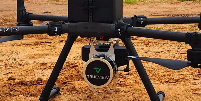
The use of drones in Texas real estate has become increasingly popular, offering a range of benefits for property surveys, marketing, and inspections. Here's how drone technology is transforming the industry:
Enhanced Property Surveys
Drones provide accurate and detailed aerial views, which are crucial for property surveys. This technology allows surveyors to capture comprehensive data on land boundaries, topography, and other critical features. With drones, surveyors can access hard-to-reach areas, ensuring that every detail is covered.
Improved Marketing Strategies
In the competitive Texas real estate market, high-quality visuals are essential. Drones enable real estate agents to create stunning aerial photos and videos that showcase properties from unique angles. This not only attracts potential buyers but also provides a better understanding of the property's layout and surroundings.
Efficient Property Inspections
Drones streamline the inspection process by quickly identifying issues such as roof damage, structural problems, and land erosion. This is particularly beneficial for large properties or those with difficult terrain. Drones can safely and efficiently inspect areas that might be dangerous or inaccessible for human inspectors.
Benefits for Title Companies
Title companies in Texas also benefit from drone technology. Accurate and efficient property surveys ensure that all necessary details are captured, reducing the risk of disputes over land boundaries and other issues. Drones provide a reliable way to gather data, making the title transfer process smoother and more transparent.
Regulatory Considerations
While the use of drones offers numerous advantages, it's important to comply with Federal Aviation Administration (FAA) regulations. In Texas, drone operators must follow specific guidelines to ensure safe and legal operation. This includes obtaining the necessary permits and adhering to privacy laws.
Future Trends
The integration of drones in real estate is expected to grow, with advancements in technology leading to even more innovative applications. From 3D mapping to thermal imaging, drones will continue to enhance the efficiency and accuracy of real estate operations.
Conclusion
Drones are revolutionizing the Texas real estate industry by providing enhanced property surveys, improved marketing materials, and efficient inspections. For title companies, real estate agents, and buyers, drone technology offers a powerful tool to gain accurate insights and streamline transactions. As drone usage becomes more prevalent, staying informed about regulations and advancements will be key to leveraging this technology effectively.
By choosing a surveying company like South Texas Surveying, which utilizes advanced drone technology, you can ensure precise and comprehensive property assessments that meet the highest standards of accuracy and efficiency.
Delivering Land Surveys with Attention to Detail
George Owens
Commercial Broker

I have worked with many surveying companies, but South Texas Surveying stands out for their exceptional professionalism, attention to detail, and commitment to their clients.
Kim Wexler
Project Manager

Their accurate and thorough surveys make my job a lot easier, their ability to communicate effectively with all parties involved is commendable. I highly recommend South Texas Surveying.
James Cart
Homeowner

As a new homeowner, I was thoroughly impressed with the professional service provided by South Texas Surveying. I high recommend their services to any one buying a home in Houston.
Contact Us
Email: [email protected]
Office Address: 11281 Richmond Ave
BLDG J, Suite 101,
Houston, TX 77082
Office Hours: Mon – Fri 8:00am – 5:00pm
Office Phone Number: 281-556-6918
11281 Richmond Ave
BLDG J, Suite 101,
Houston, TX 77082
Firm Number: 10045400
Resources
© Copyright 2024 South Texas Surveying Associates
